The 40-Year Detour: From Bubble Memory to 2026

I recently fell down a research hole involving a 1986 TRRL (Transport and Road Research Laboratory) report from Tomorrow's World (remember that? = you're old.), and honestly, I haven't been the same since. We often think of tech progress as a straight line, but looking at automotive navigation is more like looking at a chaotic series of U-turns.
In 1986, we weren't just "pre-Google Maps"; we were in a world where the "ultimate solution" was a toss-up between a massive computer in your boot and burying sensor loops in the tarmac.
The 1986 "Concept" Reality
Imagine it’s 1986. You’re sitting in a concept car. The dashboard looks like a low-budget sci-fi set. Instead of a sleek smartphone, you have what they referred to as "Bubble Memory." This was the bleeding edge: non-volatile magnetic storage tucked away in the boot, holding static map data. To know where you were, the car used Dead Reckoning. No satellites. Just a computer doing frantic math based on how far your wheels turned and which way your steering wheel was pointed from a known starting point. If you hit a pothole or took a sharp turn too fast? The computer got "lost."
The Librarian vs. The Encyclopedia
The 1986 report highlighted a classic architectural debate:
- The Standalone System: Like owning an encyclopedia. It’s offline, its in the car, it’s yours, but the second a new bypass is built, your "map" is a lie.
- The Infrastructure System: This was the wild one. Britain and Germany were looking at Roadside Loops—sensors buried under the road that would "talk" to transmitters hidden behind your number plate.
Think of it as a "Radio Librarian." As you drove over a loop, the central traffic computer would beam down data: "Careful, there's a pile-up in two miles; take the next left." It was dynamic, real-time, and incredibly expensive. The big question wasn't "Can we do it?" but "Who's paying for the roadside computers?"
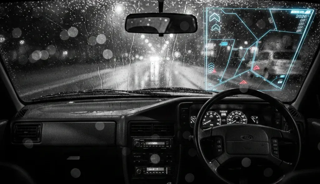
2026: The Reality Check
Fast forward forty years to 2026. The "Infrastructure vs. Standalone" debate was settled by a third and fourth player: The Satellite and the Cloud.
We didn't end up needing sensors in every mile of tarmac because we put the "loops" in orbit and the "memory" in the cloud. But look at where we are now:
- Predictive AI: We don't just avoid "pile-ups" anymore; our cars predict traffic patterns before they happen using billions of data points.
- Augmented Reality (AR) HUDs: 1986 dreamt of "digital dials." 2026 gives us AR arrows projected directly onto the windscreen, painting the path on the actual road.
- The "Un-Tech" Irony: Despite having the power of a 1980s mainframe in our pockets, there’s a growing "Retro-Futurism" movement of drivers returning to physical buttons because touchscreens are, frankly, a bit much.
The Rabbit Hole Conclusion
The most haunting part of that 1986 report? They already had Voice Guidance. Even forty years ago, a synthesized, slightly robotic voice was telling drivers to "Turn Left."
We’ve spent four decades making the maps prettier, the data faster, and the storage smaller, but the core human desire remains the same: Just tell me how to get home without hitting traffic.
If you could go back to 1986 and show a transport engineer a modern smartphone (and I guess a GPS satellite in orbit..), what do you think would blow their mind more: the satellite accuracy or the fact that the "map" also lets you order a pizza?